
Redding, CA · 96002
Top 7 Easy waterfall walks in Redding, CA

- 1
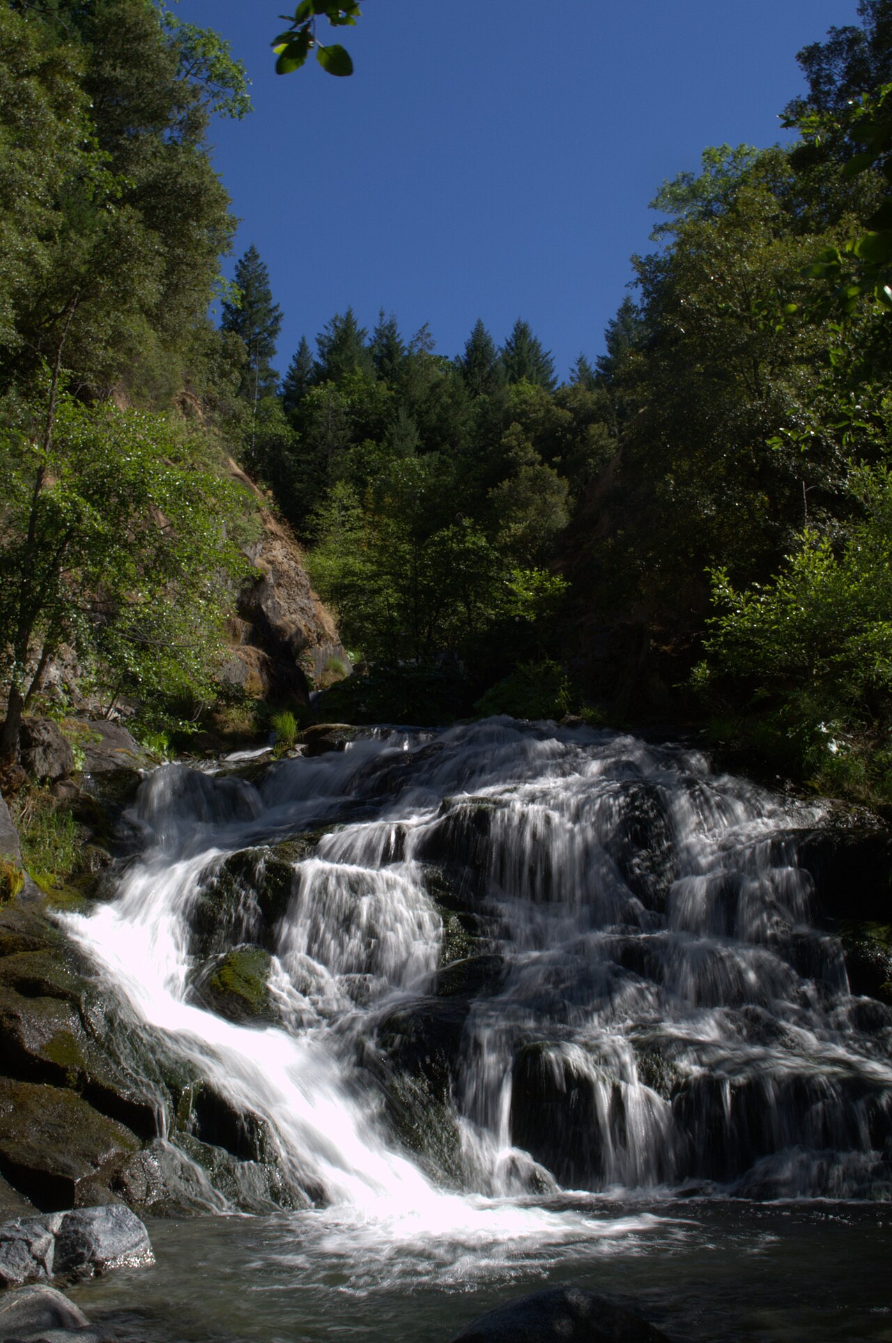
Photo: Greg Grossmeier, CC BY-SA 3.0 via Wikimedia Commons Crystal Creek Falls
Whiskeytown National Recreation Area
Trailhead: Crystal Creek Falls Trailhead, about 2 miles up Crystal Creek Rd off Hwy 299
39 min drive from 96002
- About 0.4-0.5 mi each way, flat and paved
- Easy, wheelchair-accessible to the viewpoint
The easiest waterfall near Redding: a flat, paved, accessible path to the viewpoint, a shady pool at the base, and picnic tables.
Know before you go: Whiskeytown entrance pass required. The path to the pool at the base is short, steep dirt. Watch for poison oak on the unofficial upper-falls path. The falls are man-made: water comes from an overflow structure for the Trinity tunnel.
- 2
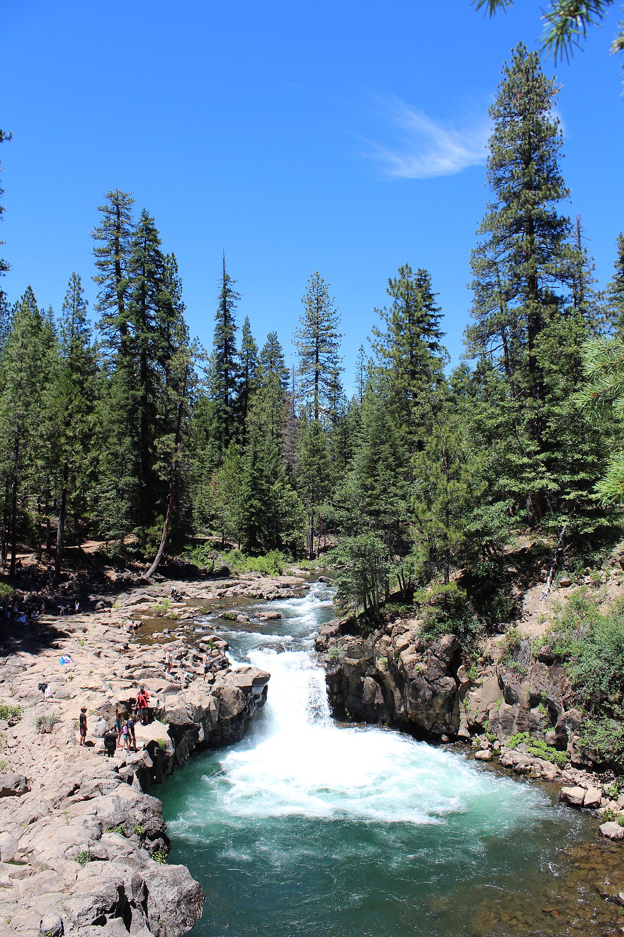
Photo: Carol Underhill, U.S. Forest Service (public domain) via Wikimedia Commons McCloud Lower Falls
McCloud River, Shasta-Trinity National Forest
Trailhead: Lower Falls Picnic Area (Rd 40N44/39N28)
96 min drive from 96002
- Steps from the parking lot; ADA overlook
- Easy
A short, wide falls that drops into a deep pool, popular for swimming. Picnic tables, toilets and drinking water. The McCloud River Trail to Middle and Upper Falls starts here (about 3.5 mi round trip for all three).
Know before you go: Seasonal: gates on Road 40N44 (off Hwy 89) close Nov 1 - Apr 1; the 2026 Forest Service closure order ran Jan 14 - May 1, 2026. Check current conditions before driving. No lifeguards; strong currents.
Check current conditions before you go
- 3
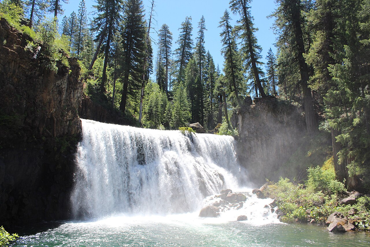
Photo: Carol Underhill, U.S. Forest Service (public domain) via Wikimedia Commons McCloud Middle Falls
McCloud River, Shasta-Trinity National Forest (Hwy 89, ~5 mi east of McCloud)
Trailhead: Middle Falls Overlook parking (Rd 40N44A), or hike 1.3 mi upstream from Lower Falls
98 min drive from 96002
- Overlook by car via a short ADA path; or 1.3 mi each way from Lower Falls on the McCloud River Trail
- Easy
The showpiece of the three McCloud falls: over 50 feet tall and about 100 feet wide, with a big swimming pool at the base.
Know before you go: Seasonal: gates on Road 40N44 (off Hwy 89) close Nov 1 - Apr 1; the 2026 Forest Service closure order ran Jan 14 - May 1, 2026. Check current conditions before driving. No lifeguards; strong currents.
Check current conditions before you go
- 4
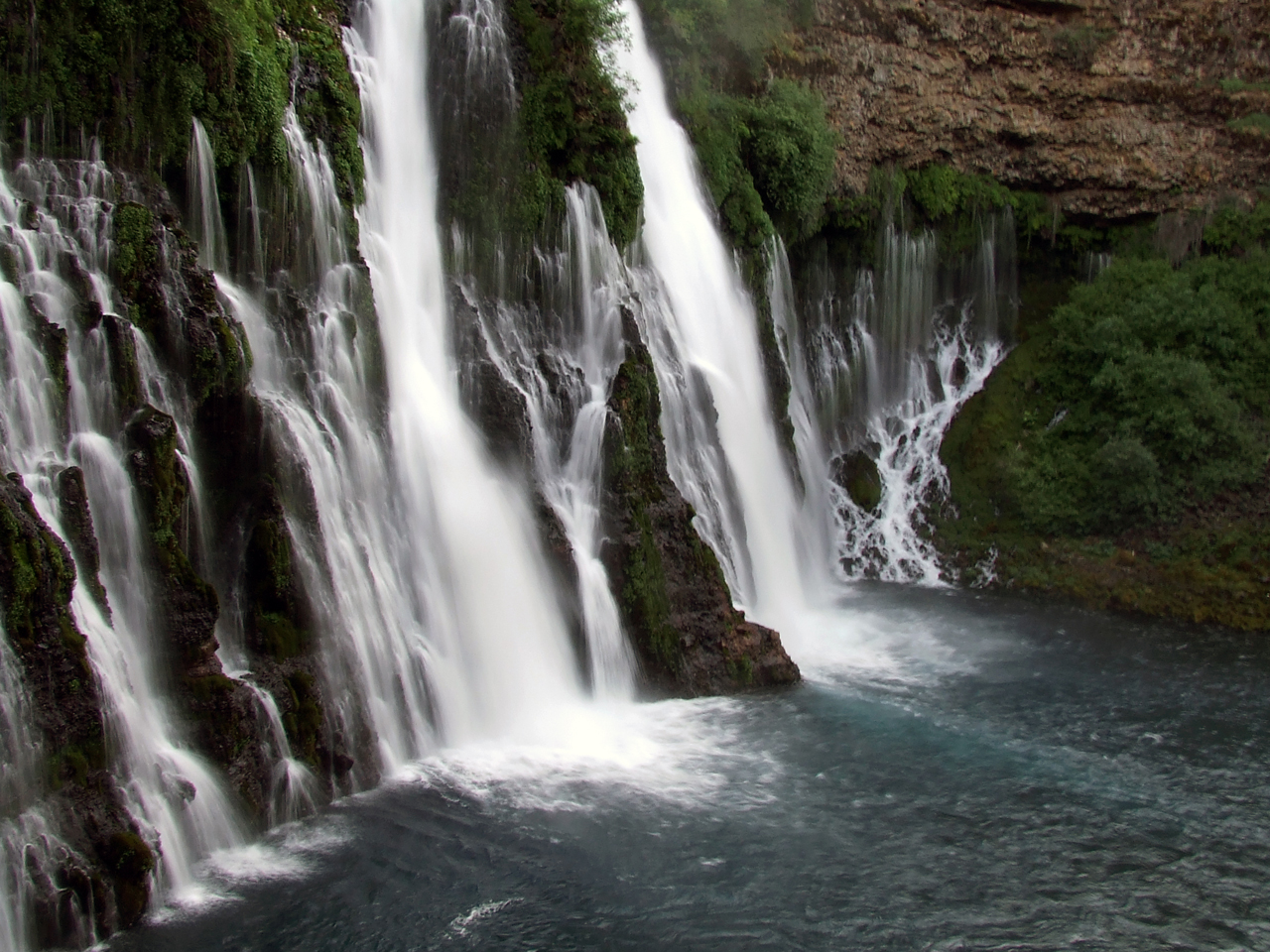
Photo: Agreene12, CC BY 3.0 via Wikimedia Commons Burney Falls
McArthur-Burney Falls Memorial State Park (Hwy 89, north of Burney)
Trailhead: Falls overlook by the main parking area
91 min drive from 96002
- Falls Loop about 1 mi, up to ~300 ft gain
- Easy to moderate
The marquee waterfall of Northern California: 129 feet, spring-fed and flowing year-round (about 100 million gallons a day, per State Parks). The Falls Loop reopened in January 2026 after reconstruction.
Know before you go: Longer drive (about 1.5 hr). Vehicle day-use fee. Day-use reservations were required Fri-Sun and holidays May 15 - Sep 27, 2026 (pilot program; expect similar in future summers). Burney Creek and PSEA trail segments closed (storm erosion); no dogs on the Falls Loop. Park may close when full. Check current conditions.
Check current conditions before you go
- 5
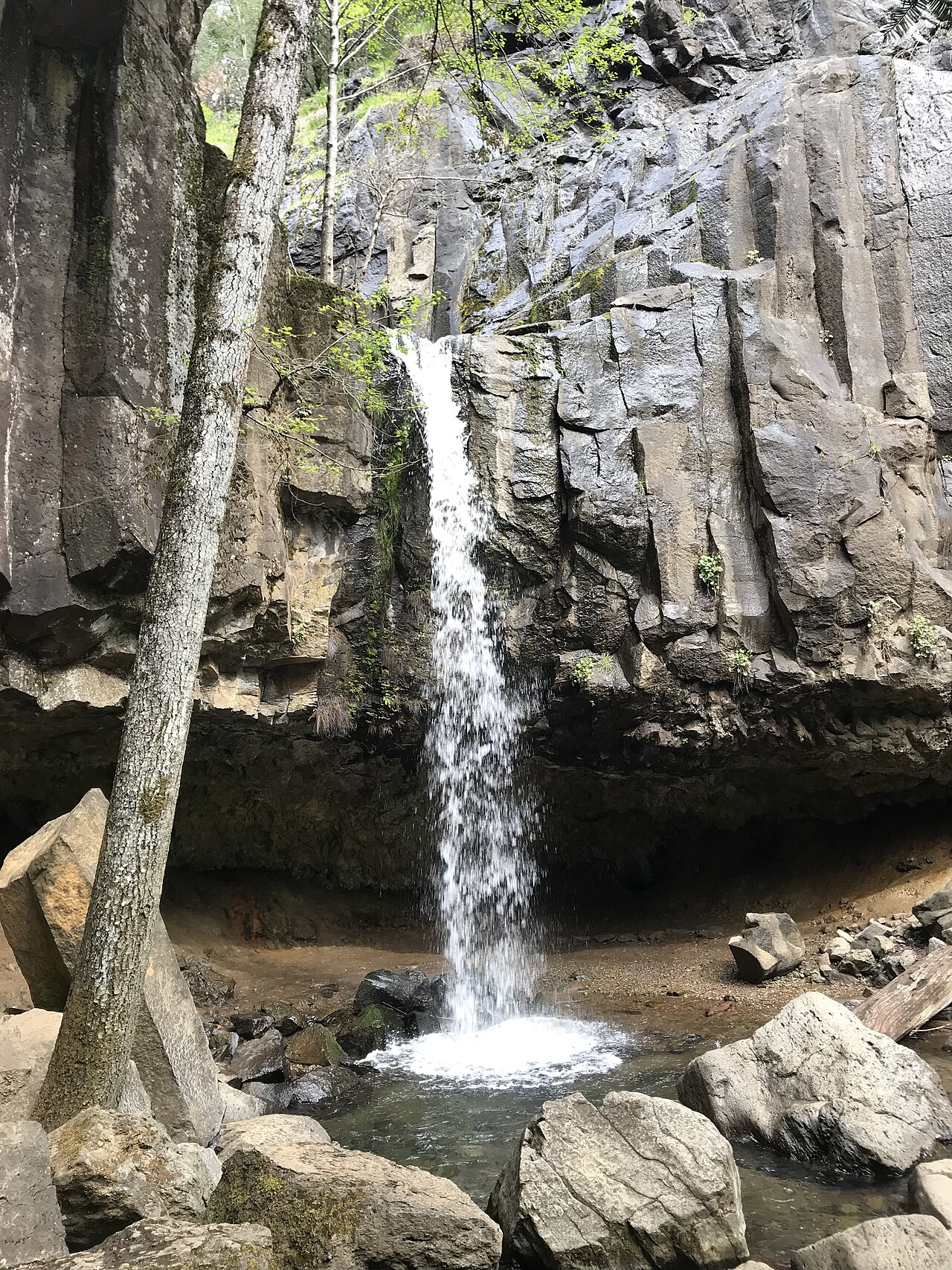
Photo: Ilya.osipov, CC BY 4.0 via Wikimedia Commons Hedge Creek Falls
Dunsmuir (I-5 exit 732)
Trailhead: Hedge Creek Falls parking, Dunsmuir Ave at Siskiyou Ave, Dunsmuir
68 min drive from 96002
- About 0.5-0.6 mi round trip, about 130-160 ft gain
- Easy (narrow and uneven in spots)
A 35-foot falls you can walk behind through a basalt cave. It flows year-round, and the trail ends at a Sacramento River overlook. An easy I-5 stop.
Know before you go: This is the legal waterfall stop in Dunsmuir. Do NOT walk the railroad tracks to Mossbrae Falls; that is trespassing. Leashed dogs OK. Free parking.
- 6
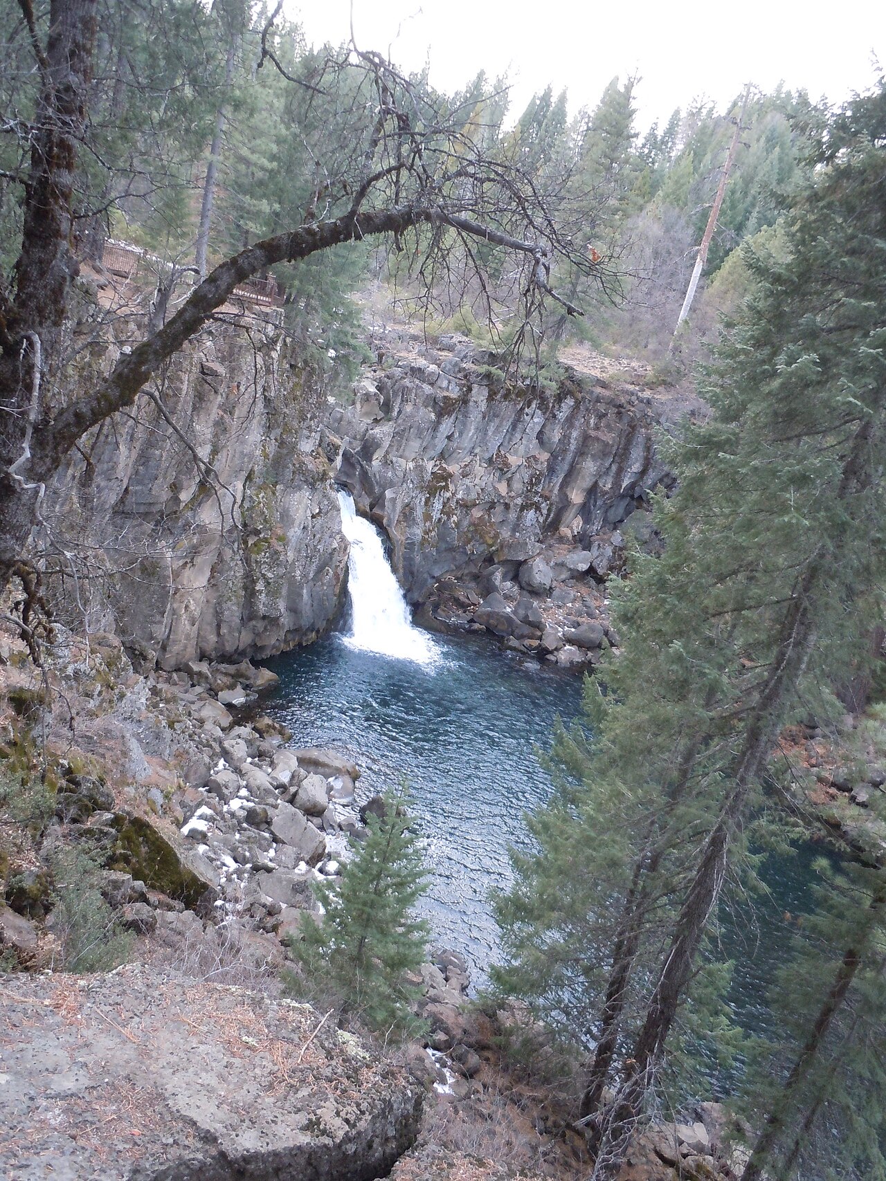
Photo: Pinecar, CC BY-SA 3.0 via Wikimedia Commons McCloud Upper Falls
McCloud River, Shasta-Trinity National Forest
Trailhead: Upper Falls day-use area (Rd 40N44B), or 0.5 mi upriver from Middle Falls
99 min drive from 96002
- Short walk to a viewing platform 90 ft above the river; 0.5 mi from Middle Falls on the rim trail
- Easy to the overlook
The river jets through a narrow rock channel into a pool. Best seen from the overlook platform.
Know before you go: Seasonal: gates on Road 40N44 (off Hwy 89) close Nov 1 - Apr 1; the 2026 Forest Service closure order ran Jan 14 - May 1, 2026. Check current conditions before driving. No lifeguards; strong currents. The climb down to the river is steep and not recommended (USFS).
Check current conditions before you go
- 7
Root Creek Falls
Castle Crags State Park (I-5 north, near Castella)
Trailhead: Root Creek Trail from Vista Point Rd in Castle Crags State Park (fee). Alternate: Soda Creek PCT trailhead at I-5 exit 726 (no park fee, longer and steeper)
67 min drive from 96002
Time is to the Castle Crags State Park entrance. Vista Point Rd adds a few minutes.
- Root Creek Trail is 1.1 mi each way (ADA-accessible, about 60 ft gain) to Root Creek. A further unofficial beaten path (about 1 mi) leads to the falls view.
- Easy to the creek; moderate and rough on the unofficial falls path
Shaded, accessible forest trail to a year-round creek under Castle Dome. A tall seasonal cascade is the reward for anyone who continues.
Know before you go: Day-use fee, open 8 a.m. to sunset. No dogs on trails. The final falls section is an unmaintained, unofficial path: steep and loose, so turn back if unsure. Best flow is in spring.
Check current conditions before you go
How we ranked this list
Editorial: easiest legal access first (paved/wheelchair viewpoint), then scenery, then drive time. NPS/USFS difficulty ratings.
Rankings are editorial; no business paid for placement.