
Redding, CA · 96002
Top 10 Waterfall Day Trips from Redding, CA

- 1
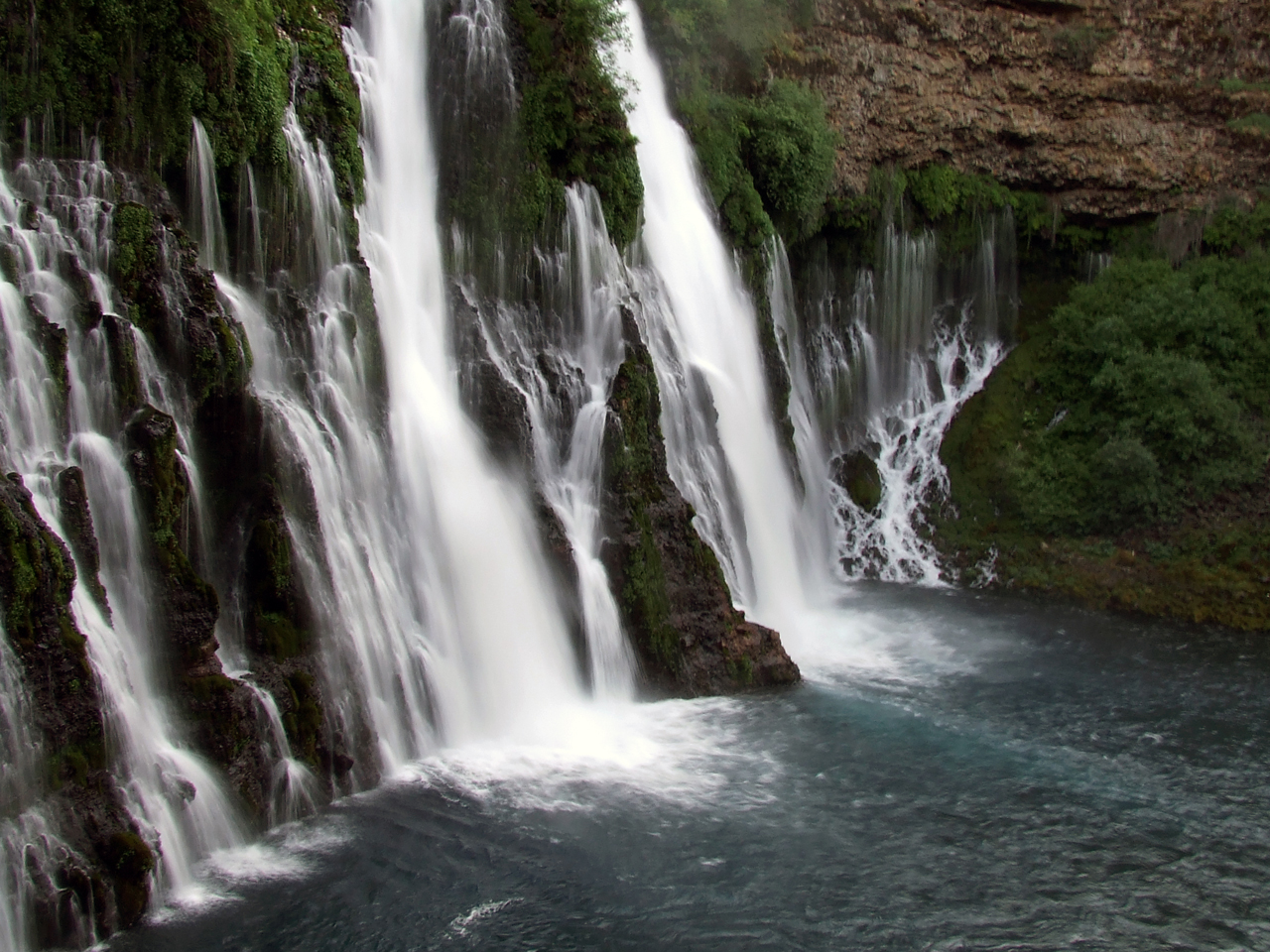
Photo: Agreene12, CC BY 3.0 via Wikimedia Commons Burney Falls
McArthur-Burney Falls Memorial State Park (Hwy 89, north of Burney)
Trailhead: Falls overlook by the main parking area
91 min drive from 96002
- Falls Loop about 1 mi, up to ~300 ft gain
- Easy to moderate
The marquee waterfall of Northern California: 129 feet, spring-fed and flowing year-round (about 100 million gallons a day, per State Parks). The Falls Loop reopened in January 2026 after reconstruction.
Know before you go: Longer drive (about 1.5 hr). Vehicle day-use fee. Day-use reservations were required Fri-Sun and holidays May 15 - Sep 27, 2026 (pilot program; expect similar in future summers). Burney Creek and PSEA trail segments closed (storm erosion); no dogs on the Falls Loop. Park may close when full. Check current conditions.
Check current conditions before you go
- 2
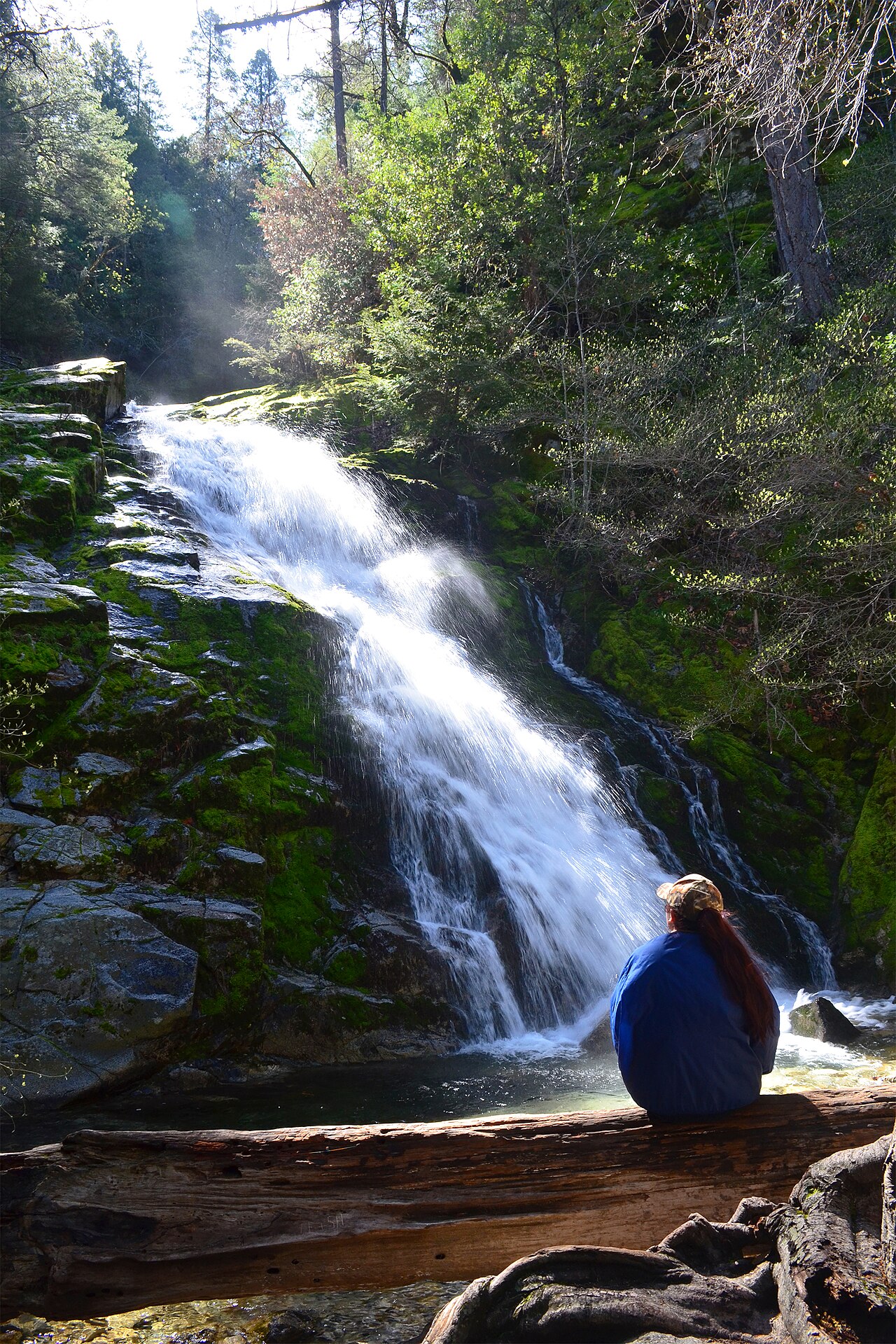
Photo: National Park Service Whiskeytown Falls
Whiskeytown National Recreation Area (west of Redding)
Trailhead: James K. Carr Trailhead, about 4 miles up Crystal Creek Rd off Hwy 299
51 min drive from 96002
- 3.4 mi round trip, about 700-750 ft gain
- Strenuous (NPS rating)
A three-tier, 220-foot waterfall, the tallest in the park. It was rediscovered by park staff in 2004, and the payoff is huge for a half-day hike.
Know before you go: Whiskeytown entrance pass required. NPS says the upper path was damaged after the 2018 Carr Fire and may be closed; do not pass closures. Expect downed trees.
Check current conditions before you go
- 3
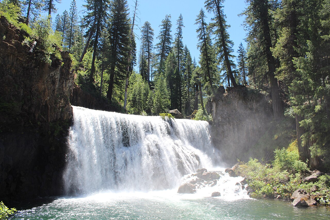
Photo: Carol Underhill, U.S. Forest Service (public domain) via Wikimedia Commons McCloud Middle Falls
McCloud River, Shasta-Trinity National Forest (Hwy 89, ~5 mi east of McCloud)
Trailhead: Middle Falls Overlook parking (Rd 40N44A), or hike 1.3 mi upstream from Lower Falls
98 min drive from 96002
- Overlook by car via a short ADA path; or 1.3 mi each way from Lower Falls on the McCloud River Trail
- Easy
The showpiece of the three McCloud falls: over 50 feet tall and about 100 feet wide, with a big swimming pool at the base.
Know before you go: Seasonal: gates on Road 40N44 (off Hwy 89) close Nov 1 - Apr 1; the 2026 Forest Service closure order ran Jan 14 - May 1, 2026. Check current conditions before driving. No lifeguards; strong currents.
Check current conditions before you go
- 4
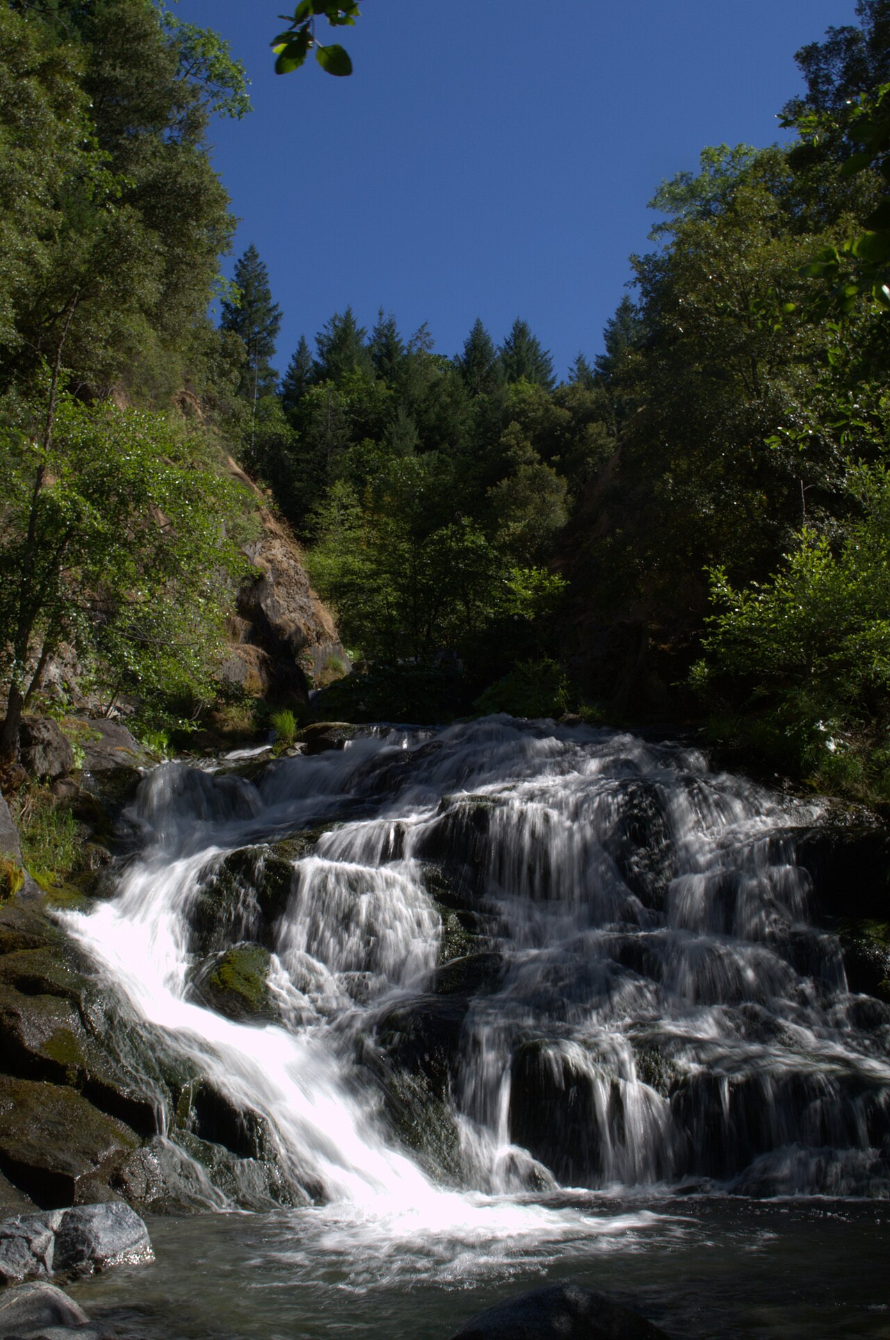
Photo: Greg Grossmeier, CC BY-SA 3.0 via Wikimedia Commons Crystal Creek Falls
Whiskeytown National Recreation Area
Trailhead: Crystal Creek Falls Trailhead, about 2 miles up Crystal Creek Rd off Hwy 299
39 min drive from 96002
- About 0.4-0.5 mi each way, flat and paved
- Easy, wheelchair-accessible to the viewpoint
The easiest waterfall near Redding: a flat, paved, accessible path to the viewpoint, a shady pool at the base, and picnic tables.
Know before you go: Whiskeytown entrance pass required. The path to the pool at the base is short, steep dirt. Watch for poison oak on the unofficial upper-falls path. The falls are man-made: water comes from an overflow structure for the Trinity tunnel.
- 5
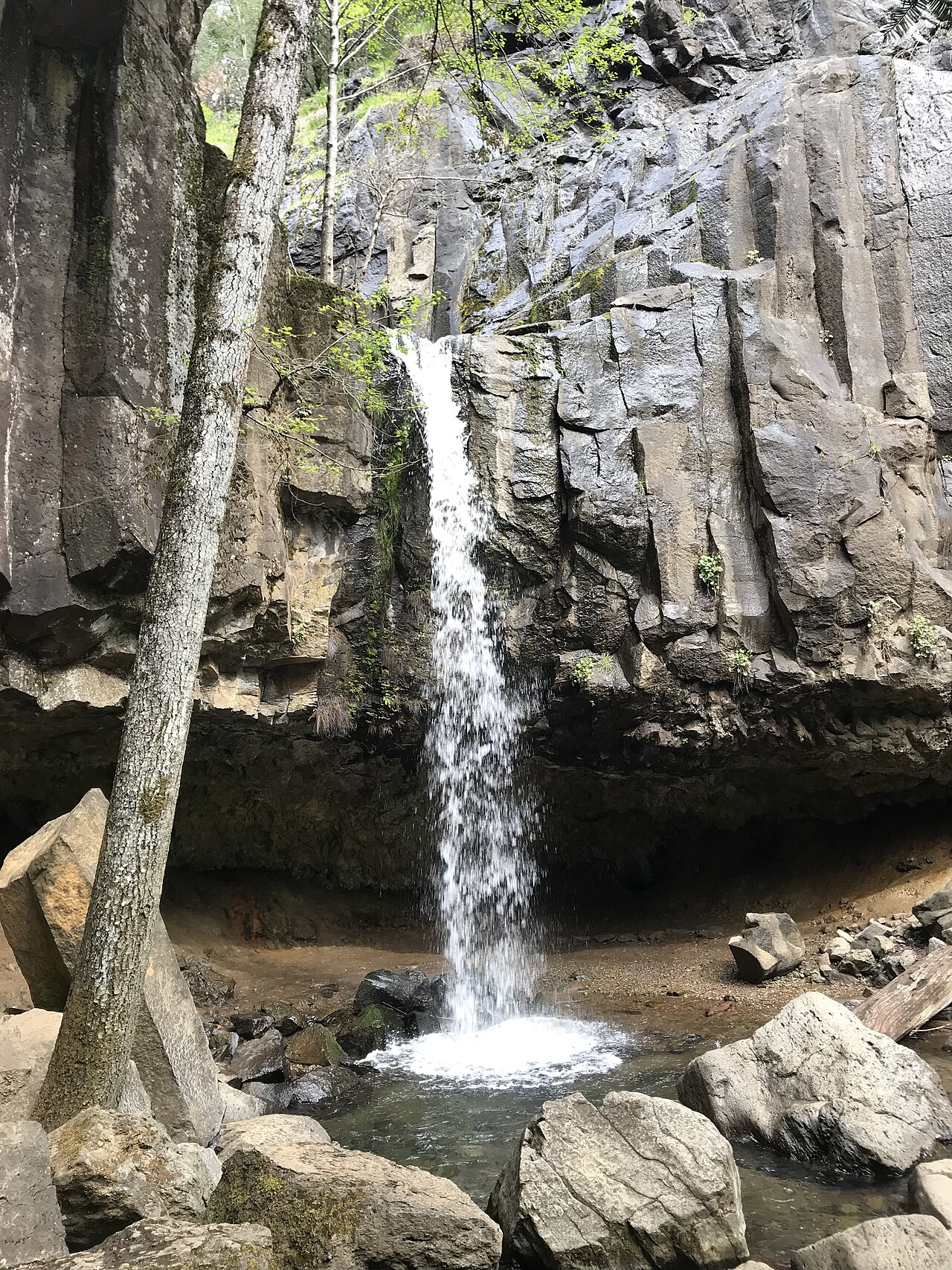
Photo: Ilya.osipov, CC BY 4.0 via Wikimedia Commons Hedge Creek Falls
Dunsmuir (I-5 exit 732)
Trailhead: Hedge Creek Falls parking, Dunsmuir Ave at Siskiyou Ave, Dunsmuir
68 min drive from 96002
- About 0.5-0.6 mi round trip, about 130-160 ft gain
- Easy (narrow and uneven in spots)
A 35-foot falls you can walk behind through a basalt cave. It flows year-round, and the trail ends at a Sacramento River overlook. An easy I-5 stop.
Know before you go: This is the legal waterfall stop in Dunsmuir. Do NOT walk the railroad tracks to Mossbrae Falls; that is trespassing. Leashed dogs OK. Free parking.
- 6
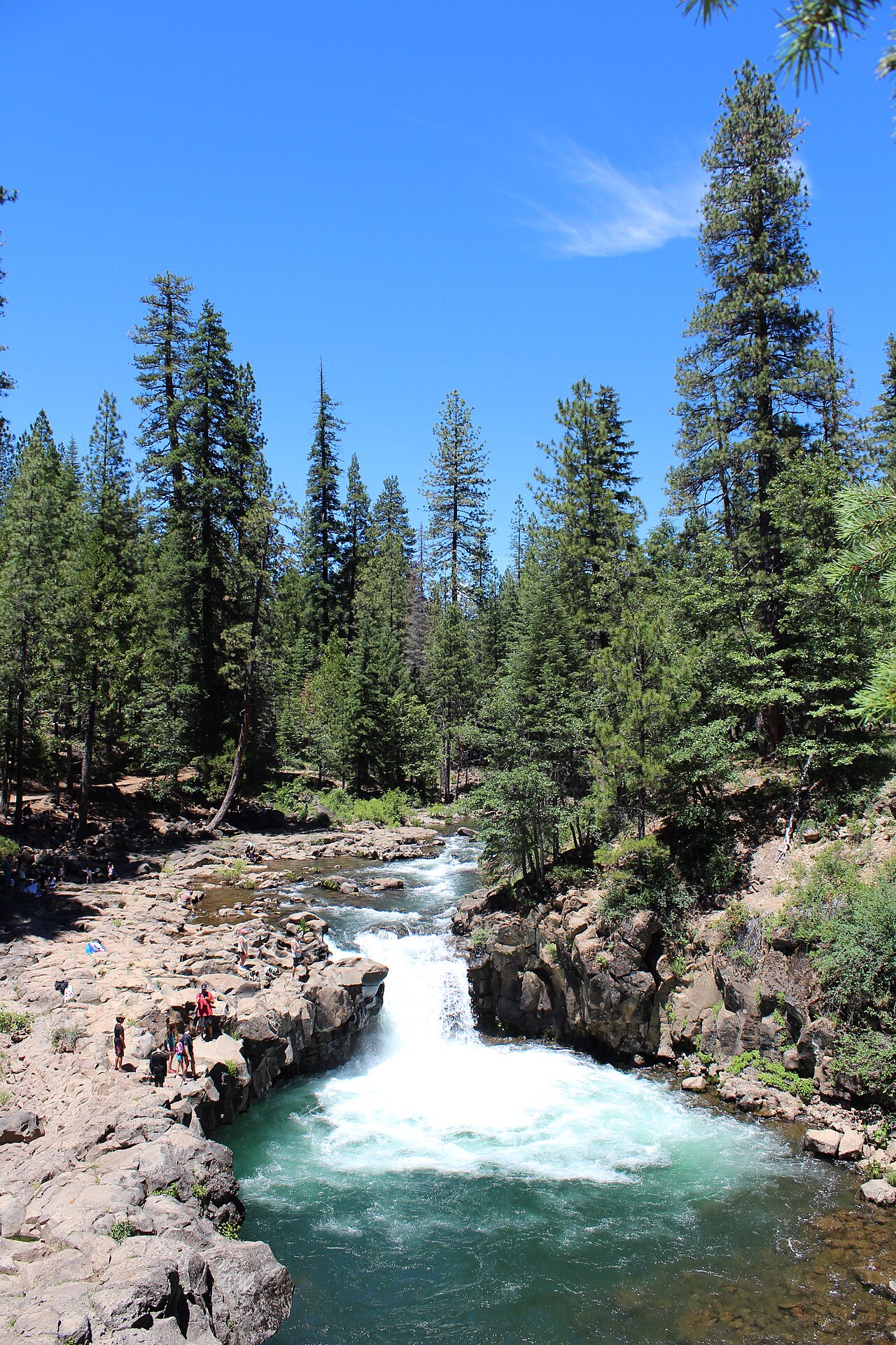
Photo: Carol Underhill, U.S. Forest Service (public domain) via Wikimedia Commons McCloud Lower Falls
McCloud River, Shasta-Trinity National Forest
Trailhead: Lower Falls Picnic Area (Rd 40N44/39N28)
96 min drive from 96002
- Steps from the parking lot; ADA overlook
- Easy
A short, wide falls that drops into a deep pool, popular for swimming. Picnic tables, toilets and drinking water. The McCloud River Trail to Middle and Upper Falls starts here (about 3.5 mi round trip for all three).
Know before you go: Seasonal: gates on Road 40N44 (off Hwy 89) close Nov 1 - Apr 1; the 2026 Forest Service closure order ran Jan 14 - May 1, 2026. Check current conditions before driving. No lifeguards; strong currents.
Check current conditions before you go
- 7
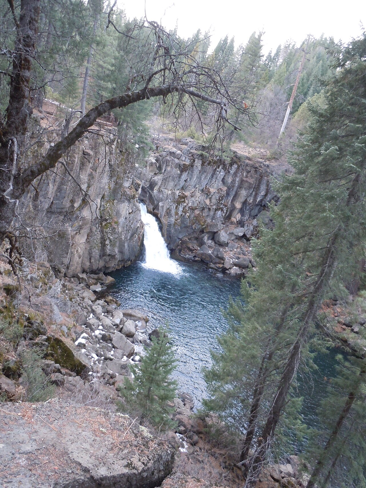
Photo: Pinecar, CC BY-SA 3.0 via Wikimedia Commons McCloud Upper Falls
McCloud River, Shasta-Trinity National Forest
Trailhead: Upper Falls day-use area (Rd 40N44B), or 0.5 mi upriver from Middle Falls
99 min drive from 96002
- Short walk to a viewing platform 90 ft above the river; 0.5 mi from Middle Falls on the rim trail
- Easy to the overlook
The river jets through a narrow rock channel into a pool. Best seen from the overlook platform.
Know before you go: Seasonal: gates on Road 40N44 (off Hwy 89) close Nov 1 - Apr 1; the 2026 Forest Service closure order ran Jan 14 - May 1, 2026. Check current conditions before driving. No lifeguards; strong currents. The climb down to the river is steep and not recommended (USFS).
Check current conditions before you go
- 8
Faery Falls
Ney Springs Creek, Mt. Shasta (off Castle Lake Rd)
Trailhead: End of dirt Ney Springs Rd off Castle Lake Rd
about 87-92 min drive from 96002
- About 1.4 mi round trip, about 250-300 ft gain
- Moderate (short steep, slick spur to the base)
A 40-50 ft falls in a forested canyon, past the stone ruins of the 1800s Ney Springs resort.
Know before you go: Rough unpaved Ney Springs Rd; high clearance often needed, and it can be impassable when muddy. Roads subject to seasonal winter closure; check current conditions. Final spur is steep and dangerous when wet or icy. No facilities.
Check current conditions before you go
- 9
Boulder Creek Falls
Whiskeytown National Recreation Area (south side)
Trailhead: Mill Creek Road Trailhead (end of a 2-mile steep, narrow gravel road off Carr Powerhouse Rd)
28 min drive from 96002
Time is to Carr Powerhouse only. Add the slow 2-mile gravel climb on Mill Creek Rd.
- 1.1 mi each way (2.2 mi round trip), about 200 ft gain, with a creek ford
- Moderate (NPS rating)
A series of cascades in a quiet canyon, and a great place to cool your feet on warm days. NPS reopened it in 2022 after clearing a 13-foot log jam left by the Carr Fire.
Know before you go: Whiskeytown entrance pass required. Creek ford, so water can be high in winter and spring. The road is steep, narrow gravel. Alternate South Shore Dr route: 2.8 mi each way, strenuous, 3 fords.
Check current conditions before you go
- 10
Root Creek Falls
Castle Crags State Park (I-5 north, near Castella)
Trailhead: Root Creek Trail from Vista Point Rd in Castle Crags State Park (fee). Alternate: Soda Creek PCT trailhead at I-5 exit 726 (no park fee, longer and steeper)
67 min drive from 96002
Time is to the Castle Crags State Park entrance. Vista Point Rd adds a few minutes.
- Root Creek Trail is 1.1 mi each way (ADA-accessible, about 60 ft gain) to Root Creek. A further unofficial beaten path (about 1 mi) leads to the falls view.
- Easy to the creek; moderate and rough on the unofficial falls path
Shaded, accessible forest trail to a year-round creek under Castle Dome. A tall seasonal cascade is the reward for anyone who continues.
Know before you go: Day-use fee, open 8 a.m. to sunset. No dogs on trails. The final falls section is an unmaintained, unofficial path: steep and loose, so turn back if unsure. Best flow is in spring.
Check current conditions before you go
More waterfalls worth the drive (not ranked)
Potem Falls
78 min drive from 96002
- 0.3 mi each way, rocky with drop-offs
A 70-foot year-round falls above the Pit River arm of Shasta Lake.
Know before you go: Fenders Ferry Rd is dirt; USFS recommends 4WD or high clearance. Very limited parking. The area was closed in 2025 for the Green Fire (through at least Jan 31, 2026). The USFS page (updated Jul 10, 2026) shows no closure, but confirm.
Check current conditions before you go
Kings Creek Falls (Lassen Volcanic NP)
90 min drive from 96001
- 2.8 mi round trip, moderate (NPS)
A high-country cascade in Lassen's backcountry.
Know before you go: Seasonal: the Lassen highway closes in winter. Dixie Fire burn area. Steep sections. Park entrance fee.
Check current conditions before you go
Mill Creek Falls (Lassen Volcanic NP)
102 min drive from 96001
- About 3.7 mi round trip, moderately strenuous (NPS)
Lassen's tallest waterfall (75 ft). The trail starts near the Kohm Yah-mah-nee Visitor Center.
Know before you go: Dixie Fire burn area hazards. Snow in winter and spring. Park entrance fee.
Check current conditions before you go
Mossbrae Falls is not included: there is no legal public access, and walking the railroad tracks is trespassing. Source 1 · Source 2
How we ranked this list
Falls are ranked by how much payoff you get for the trip from your ZIP.
- Drive time from your ZIP
- Legal public access
- Hike difficulty and length
- Size of the falls and scenery
Editorial ranking by waterfall scenery and size, ease of legal access, and hike difficulty. Drive time is a factor, not a cutoff. Drive times are one-way estimates from OpenStreetMap routing (OSRM), no traffic, from 1733 Market St (96001), 4000 Victor Ave (96002) and 1755 Lake Blvd (96003). Allow extra time for gravel roads and parking.
96002 (east Redding) adds about 7-8 minutes to the Whiskeytown falls. 96003 (north Redding) is about 3-5 minutes faster to the I-5 north falls (Hedge Creek, Castle Crags).
Verified Oct 11, 2026.
Rankings are editorial. No business or agency paid for placement.
Rankings are editorial; no business paid for placement.